States with National Parks
Home
Travel
Main NPS
Multi-State National Parks
Death Valley National Park (California, Nevada)
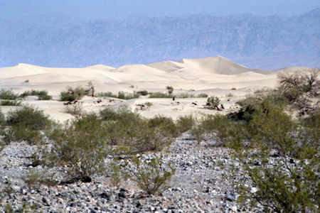
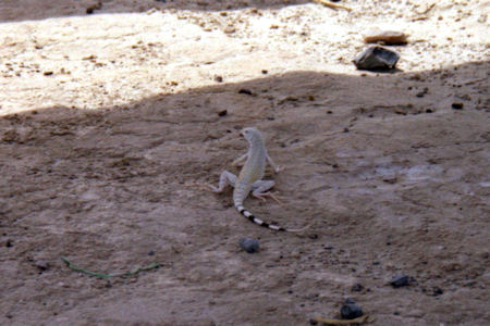
9/13/1988 Early start to cross Death Valley [NP in CA] while it was still cool(er) (93 deg. already). Strange land -
not exactly as we pictured it - some sand dunes but miles and miles and miles of very low dried out plants. Water tanks every once in a
while at the side of the road. Mountains all around way off in the distance. Had a coffee break in the shade of mini-trees at the Visitor
Center near the eastern boundary of the desert ... .
The dunes from afar
|
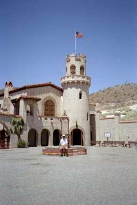
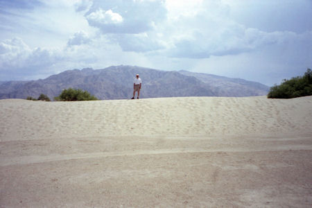
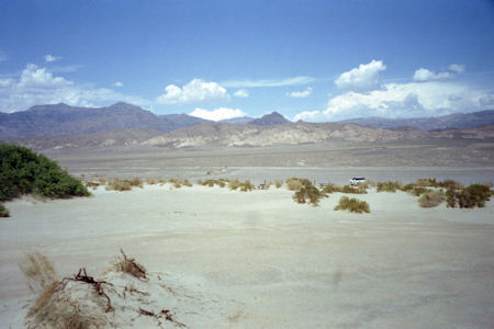
5/26/1999 Stopped in Death Valley [NP in CA] at Scotty’s Castle. A man
named Scott lived here with a couple named Johnson, who financed Scott (a gold
mine fraud). A beautiful Spanish style home of the 1930’s. Best room was the
music room with a full theater organ, which was played (great!). Headed through
Death Valley, with a stop at the Sand Dunes. Very hot here! On the way out to
Lone Pine, a big delay because the road was washed out due to flash floods – had
to ford the flood, slowly.
Me at Scotty's Castle ...
|
... and on a dune
|
The dunes and mountains
|
A local guide
|
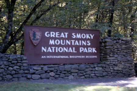
Great Smoky Mountains National Park (North Carolina, Tennessee)
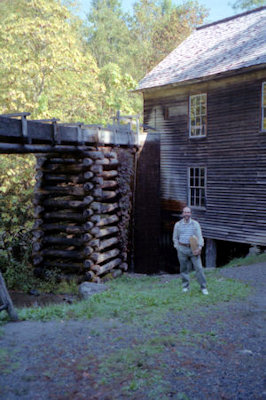
10/1/1994 Drove towards Great Smoky Mountains National Park [NS, TN]. Clear skies and sunny but some patches of dense fog.
Passed through some touristy little towns, then hit park visitor center. Walked around a model pioneer farm with nice setting on a river and
very realistic buildings. Looked around the center, and continued a short distance to an 1800s gristmill that used a water turbine rather than
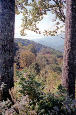
water wheel. Saw corn being ground, and bought some corn meal. Continued driving through the park with beautiful views of mountains with some
fog patches and leaves just starting to turn. Drove down the road to Clingman's Dome and started walking up the trail to the observation tower,
but turned back because it was more strenuous than we cared for. Drove the rest of the park road and ended up in Gatlinburg.
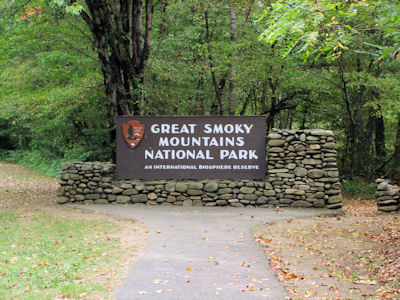
The park sign
|
Me at the gristmill
|
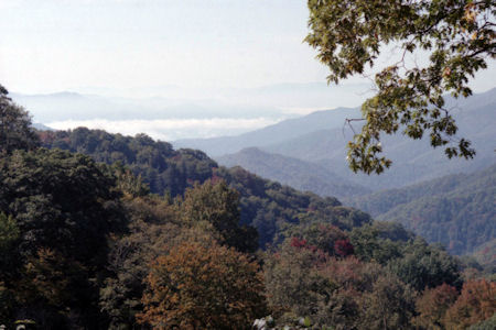
One great view ...
|
... after another
|
9/27/2007 Drove a very short way into Great Smoky Mountains NP [NC, TN] and to the Mountain Farm (also in the [Blue Ridge]
NHA). Strolled around the working farm, and a brief visit to the visitor center. Drove the N-S length of the park, stopping at vistas along the
way. Clouds and a brief rain made for not perfect but still beautiful views. Stopped at the peak on the NC-TN line for a good view and a stroll
on the Appalachian Trail.
The park sign
|
The Mountain Farm

|
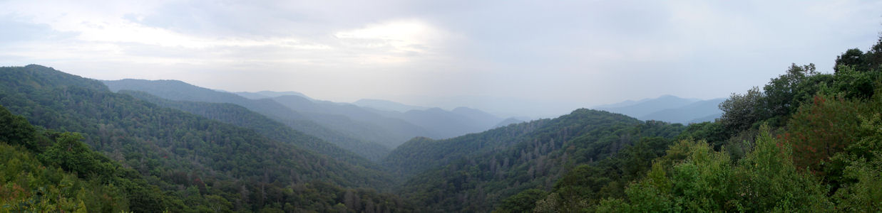
Nice views despite the rain
|
A visitor near the AT
|
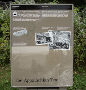
AT interpretive signage
|
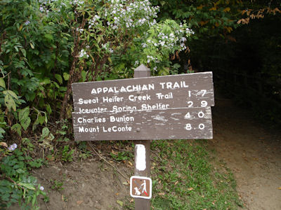
AT waypoints from here
|
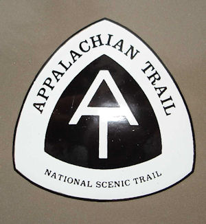
The NPS trail medallion
|
A view down the AT

|
Yellowstone National Park (Idaho, Montana, Wyoming)
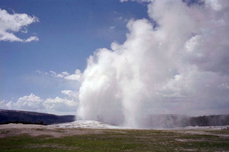
9/10/1985 Off to Yellowstone [NP in WY][via John D. Rockefeller Memorial Parkway] - stops at scenic areas on the
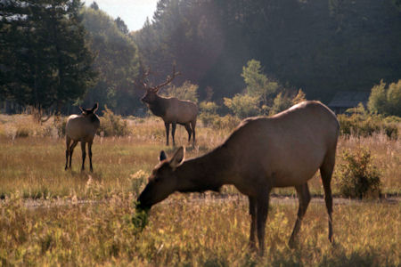
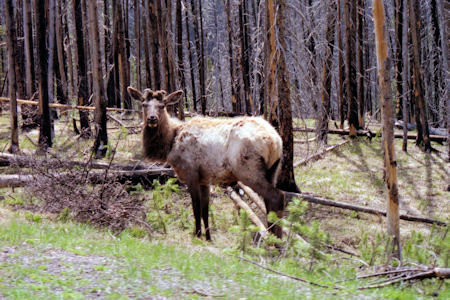
way including Old Faithful (watched twice - before and after lunch). Saw Bison, Bighorn (or Rocky Mt.) Sheep, Wapiti (Elk). Spent night
at Westernair Motel in Gardiner, Montana. Dinner at Town Loft.
9/11/1985 Back to Yellowstone to finish up. Picnic lunch. Left park at 3:00.
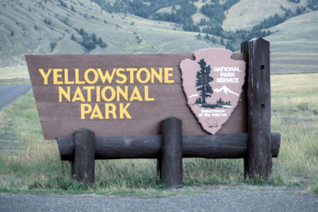
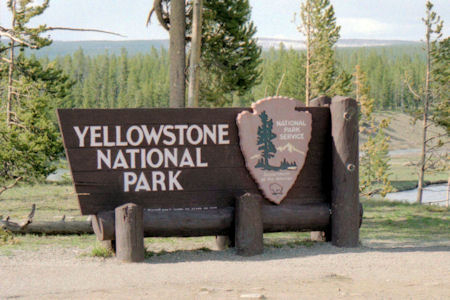
The park sign
|
Old Faithful from a distance ...
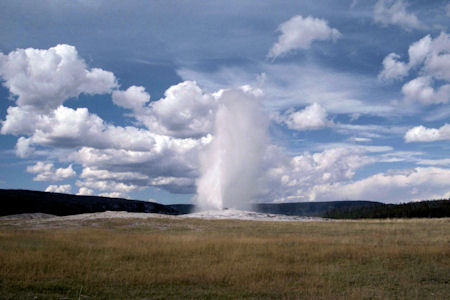
|
... and up close
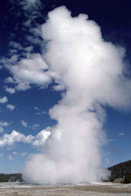
|
Elk in a glade
|
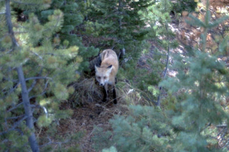
A shy fox
|
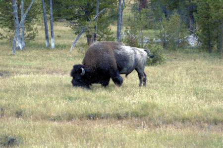
Lots of Bison ...
|
... and one up close
|
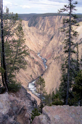
Grand Canyon of the Yellowstone
|
Mammoth Hot Springs

|
Bubbling hot mud
|
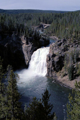
Yellowstone Lower Falls
|
5/30/1995 Up into Yellowstone National Park [WY][via John D.
Rockefeller Memorial Parkway]. Lewis Lake looked frozen over (had a snowball
fight here) and a few feet of snow near the continental divide, which we crossed
three times on the way to Old Faithful. Notes: 1) weather all day perfect -
sunny, warm, breezy, 2) Saw great views of animals - mule deer, elk and moose
(and 1 bison near Old Faithful). Tea and snack at Old Faithful Lodge [Inn NHL],
and watched the eruption.
The park sign
|
Old Faithful
|
What are you looking at?
|
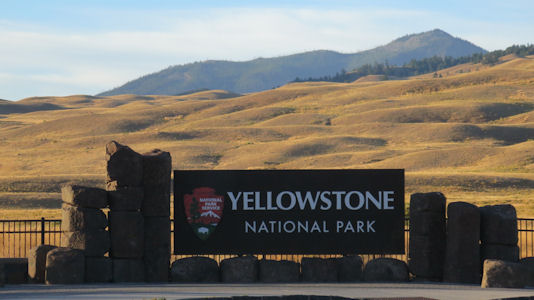
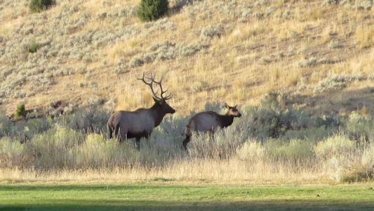
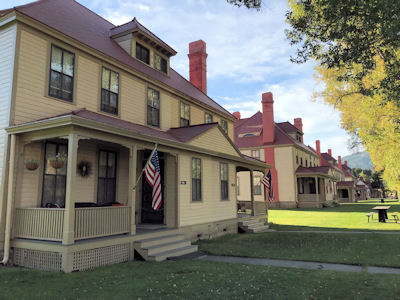
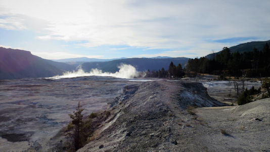
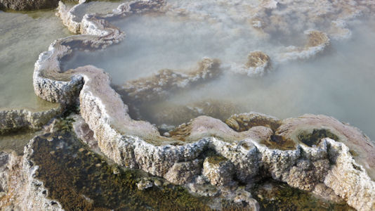
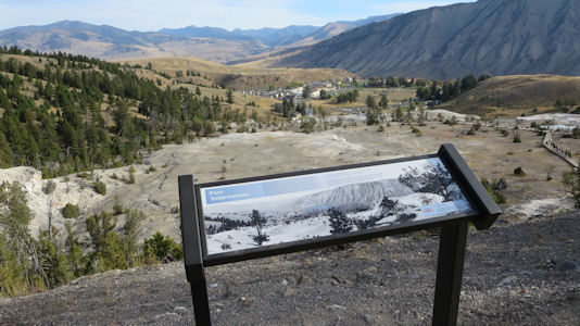
9/22/2018 Got gas and snacks, and headed right into Yellowstone NP in Wyoming on another beautiful day. First stop, right
after the entrance, Fort Yellowstone NHL. This is an Army fort, established in 1891 at Mammoth Hot Springs to effectively manage Yellowstone
National Park. While walking around looking for a good photo in the low and bright morning sun, we spotted an elk. Cameras out! Then we realized
that they were all over. We even saw a big buck with his harem hanging out by one of the buildings. He and others were making the cool and eerie
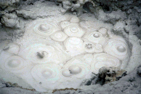
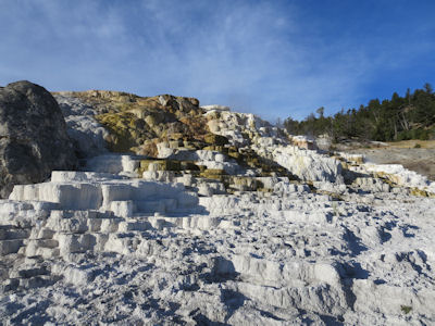
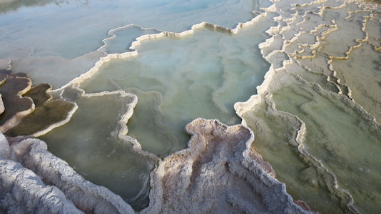
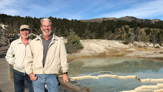
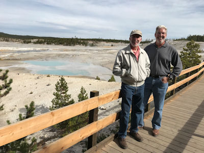
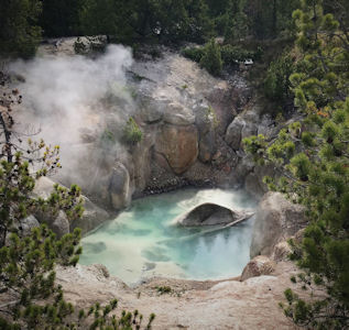
elk call. Moving on we parked at the base of the Mammoth Hot Springs for a view of one of the smaller cascade areas. We then drove to the top
of the area, parked, and walked down the stairs and boardwalks to check out the very cool features. There were cascades flowing over the rippled
stone, down to pools of pastel colors in the white mineral build-ups. There was the smell of sulfur in the air as we walked back up the stairs,
puffing a bit in the thinner air. Heading around the Grand Loop road we saw signs to expect delays ahead, and suddenly ran into stopped traffic.
We hung out there for about 25 minutes, then slowly trailed a follow-me truck for many miles. Unfortunately the construction area covered one
of our NHLs - Obsidian Cliffs, an important source of lithic materials for prehistoric peoples in what is now Yellowstone National Park. In one
of our lamer NHL snags, I took video for a screen grab of the Obsidian Cliff Kiosk amongst the parked construction vehicles while Ken slowly
cruised by, not realizing that the Cliffs were the NHL! Luckily we had noted the cliffs, and I did swing the camera momentarily up to them.
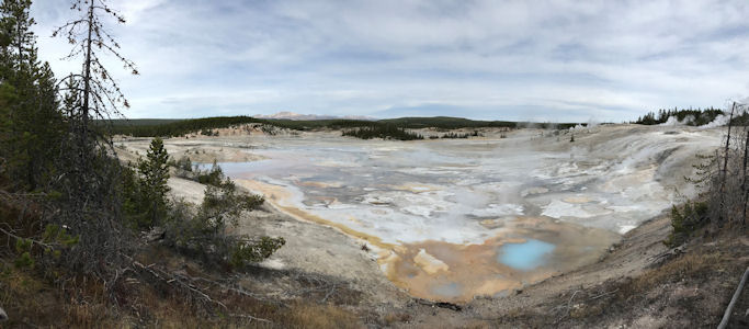
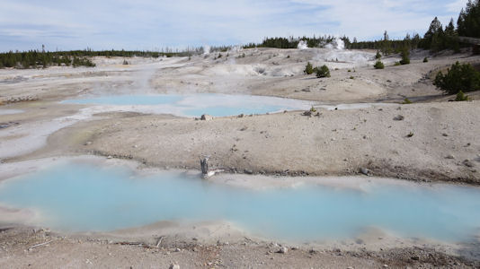
We stopped for an uninspiring view of the Norris Basin Geysers, and then drove down to the main viewing area. After circling through the parking
area with no luck (park was quite crowded) we headed for the overflow area. We walked down towards the viewing area and stopped first at the
entrance gate building which is actually the Norris Museum, part of the Norris, Madison and Fishing Bridge Museums NHL, a conglomeration of three
separate "trailside museums" within Yellowstone National Park designed by architect Herbert Maier. Not much to do other than photos with a lot of
annoying tourists in the way, so we walked down to the geyser area. This is really unique and quite impressive. The area is broad and flattish
with pastel pools and low cascades of steaming water. Here and there are bubbling and popping mini-pools, and scattered about are larger geyser
holes. These would go off randomly, spewing steam into the air and adding to the heavy sulfur smell. We spent some time here taking a gazillion
photos, then hiked back to the car. We continued down to the Canyon Village and bought some wraps and chips (and a Highlander Bison Tale Pale
Ale from Missoula Brewing Company for Ken) to eat outside under the somewhat disturbing watch of some huge ravens. Our next goal was the Grand
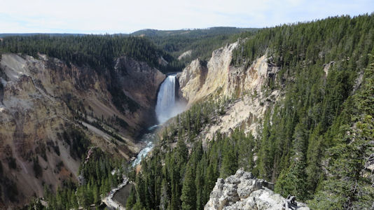
Canyon of the Yellowstone. We attempted some views of the Upper Falls from the South Rim Drive but were unsuccessful due to a closed parking area,
so we went back into the North Rim where everybody else was. We were able to squeeze into a questionable spot at the Lookout Point and walked
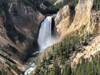
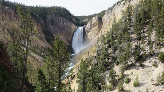
over to the viewpoint – whoo-hoo! There were the beautiful Lower Falls of the Yellowstone thundering into the Grand Canyon - tight narrow walls
of yellow rock. While enjoying this view we saw that there were people far below in the canyon on a boardwalk at Red Rock Point. After looking
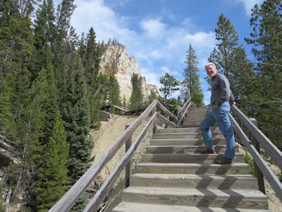
at our watches, and the steepness of the trail down, we elected to go for it. Going down was not bad, although some of the descents and switchbacks
had uneven footing. The last little section was on boardwalk and stairs, bringing us to a fantastic view of the falls from eye level. Even
the sound was better here. Looking up 500 feet above us we could see the tiny dots of people looking down from where we had been. Finishing
up our dozens of photos, we quit procrastinating and headed back up. In the long run it wasn’t bad at all - we fell back into our Catskills
mode of taking a steady pace to a waypoint ahead, then resting on a flat in the shade until the heart pounding went away. Back in the car we
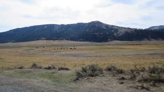
continued up the loop road, then headed east on the northeast entrance road into the Lamar Valley, with the hopes of seeing wildlife which is
known to be found there. On the loop road we saw people with telescopes and long-lens cameras looking at something on a rock face, and Ken was
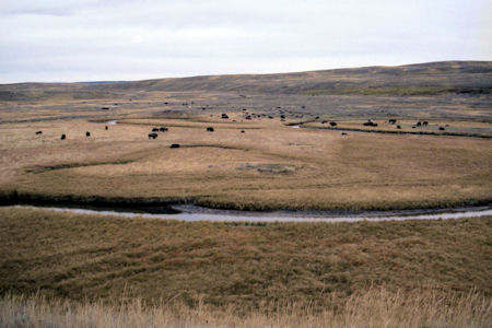
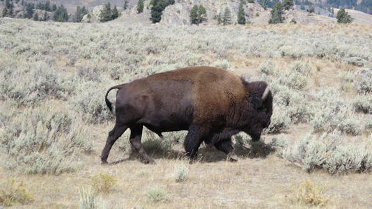
pretty sure the white dot he saw was a sheep. In the Valley we did stop for photos of one lone Bison lumbering alongside the road, but then
further along saw hundreds of them in herds in the distance, and one clump only feet from the road on both sides. Continuing east out of the
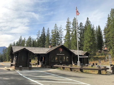
park back into Montana we stopped at the Northeast Entrance Station NHL, a 1935 rustic log building designed by the National Park Service on
the road into Yellowstone National Park.
The park sign
|
Elk near ...
|
... Fort Yellowstone NHL
|
Base of Mammoth Hot Springs
|
Above Mammoth Hot Springs
|
Cool pool formations
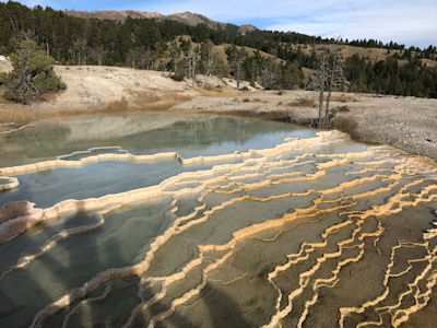
|
A close-up
|
Ken and me by the pools
|
Close-up of the mineral formations
|
Distant view of Fort Yellowstone
|
Norris Museum NHL
|
Norris Basin Geysers area
|
A look at the mineral pools
|
Ken and me on the boardwalk
|
A deep pool
|
Lower Falls of the Yellowstone from Lookout Point
|
A closer look
|
Another beautiful view from down below
|
Ken on the long climb up
|
The Lamar Valley ...
|
... and resident
|
Northeast Entrance Station NHL
|